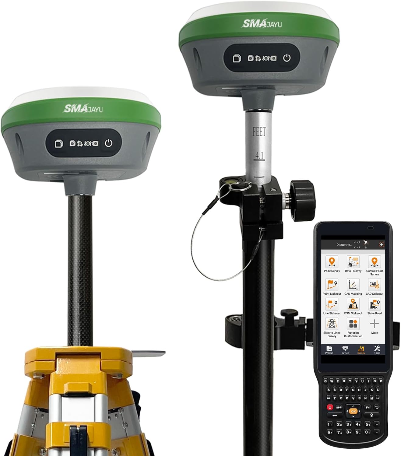
SMA26 RTK GNSS GPS Surveying Equipment with IMU Rover & Base, 1408 Channels, 1cm Accuracy, Upto 10km Range, NOAA Certified, Handheld Collector & Survey Software
Category
Agriculture
Sub-Category
Accessory
Completed orders
0
Price
$2600.00
Delivery Cost
$300.00
Minimum Order
1
pieces
Location
88 Zhuguang North Road, Xili, Nanshan District, Shenzhen, Guangdong Province, China, , ,
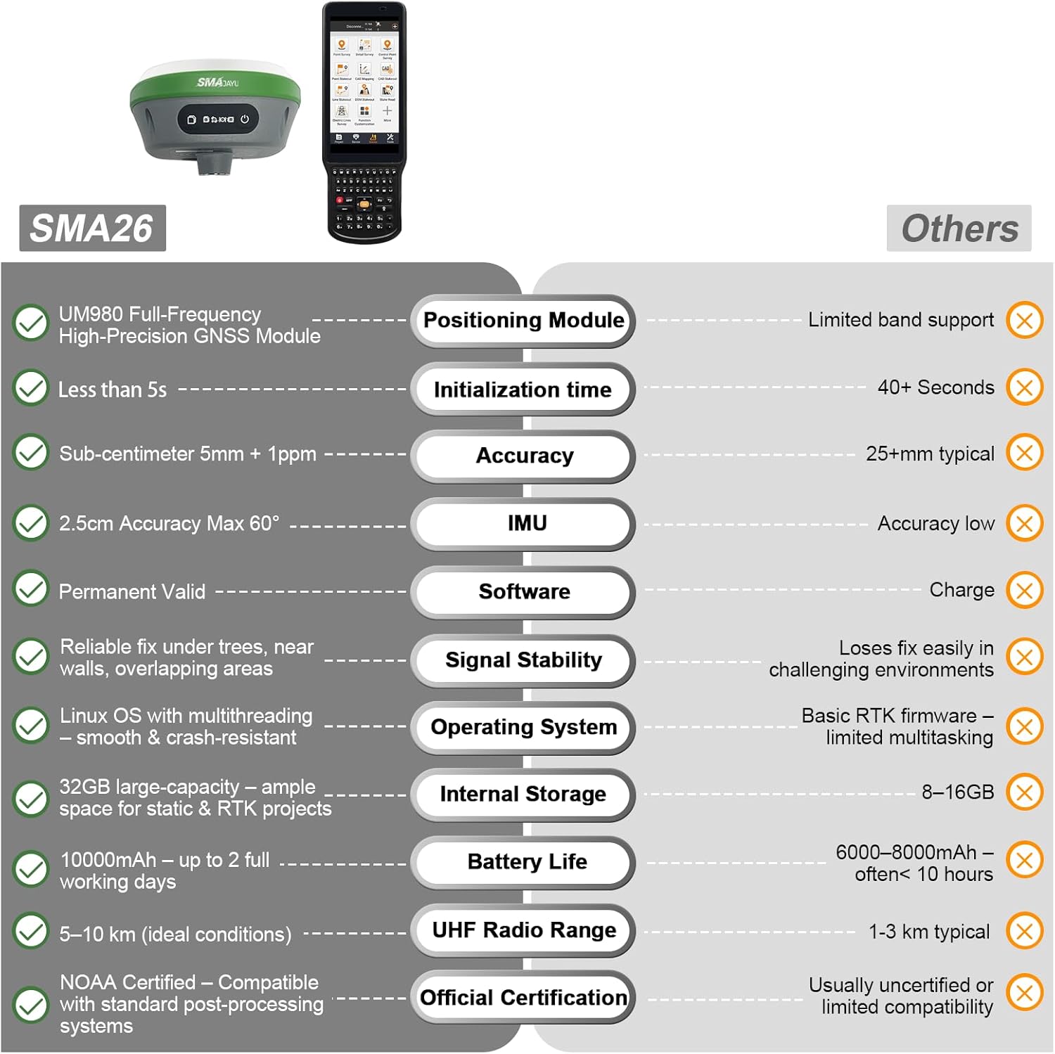
【NOAA Certified】 SMA26RTK is officially certified by NOAA and fully compatible with standard post-processing systems, ensuring reliable performance for precise geospatial data collection
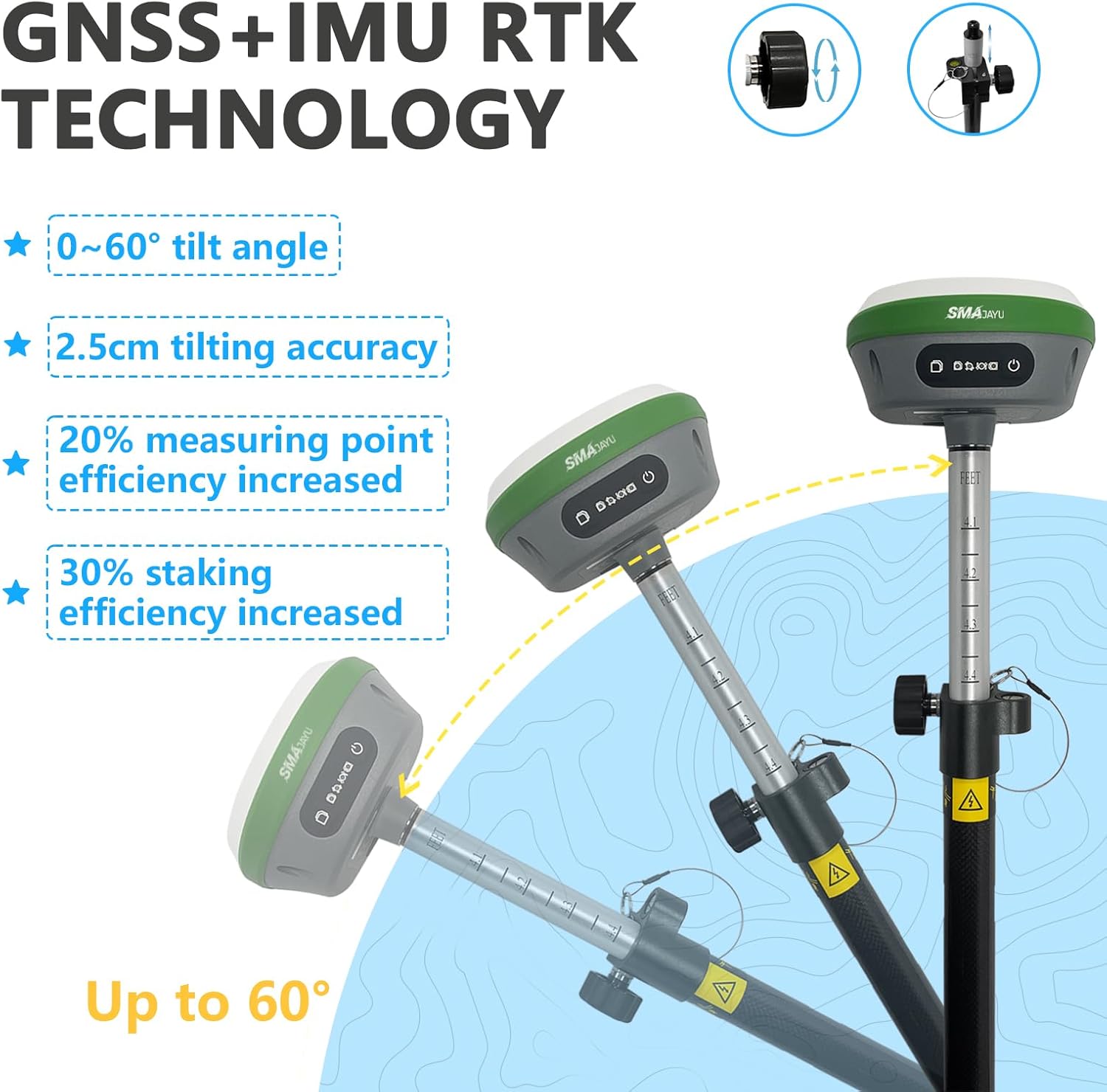
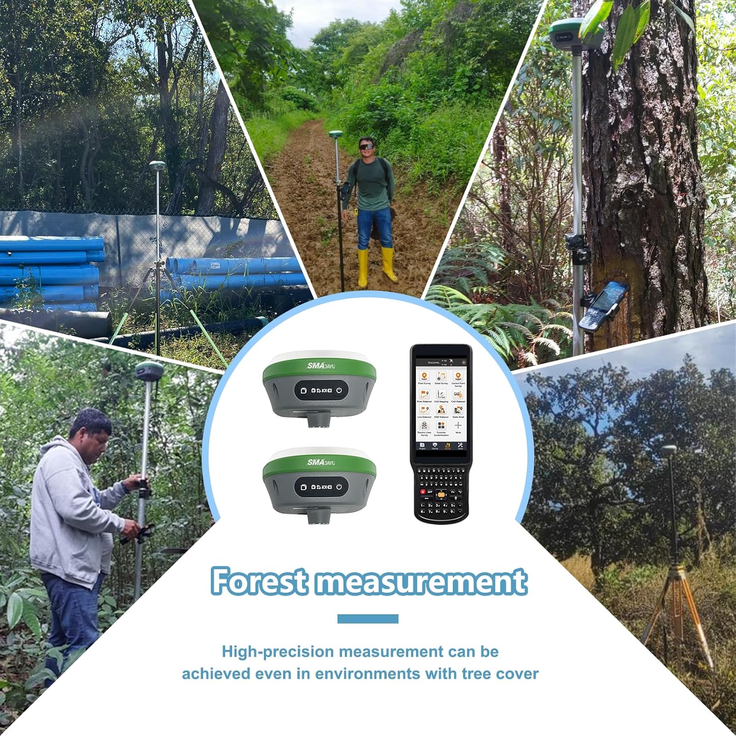
【10km Extended UHF Communication Range】 Enables 5 to 10 km UHF data transmission between rover and base under ideal conditions (no obstacles or interference) — perfect for large-area applications such as agriculture, construction, and topographic surveying
【0.5cm Exceptional RTK Accuracy】 Delivers 3mm–8mm accuracy when surveying with rover + base, based on real-world buyer feedback and extensive field testing
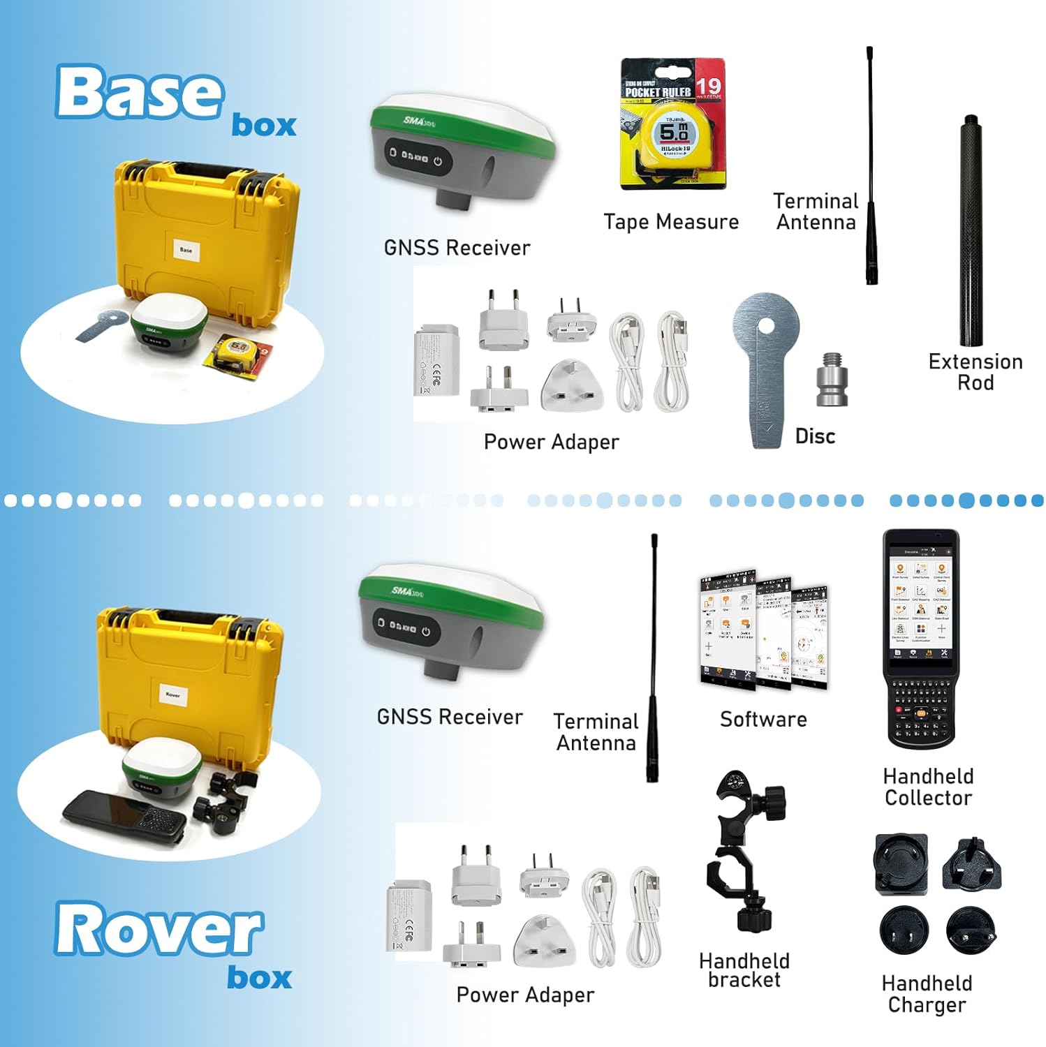
【60° Advanced IMU Tilt Compensation】 Supports 30° to 60° tilt measurement with centimeter-level accuracy, allowing efficient data capture even when the receiver is tilted or on uneven ground 【Switchable Rover & Base】The SMA26 Rover and Base can easily be switched freely, allowing for seamless and flexible surveying in various field conditions. This capability reduces setup time and enhances workflow efficiency for both large-scale and small
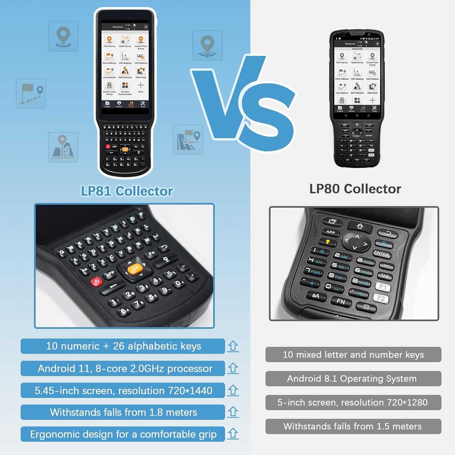
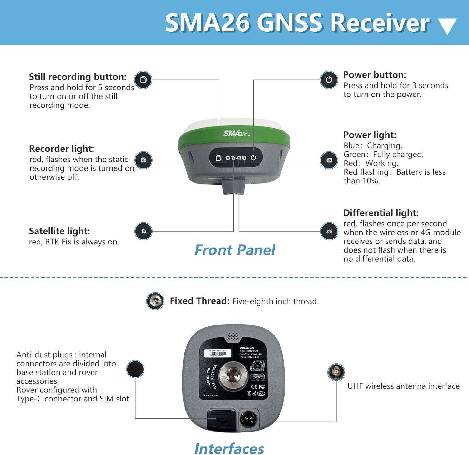
【High-performance hardware】32GB storage capability; Initialization time<5s ; 【10,000mAh Long-Lasting Battery】Features a powerful 10,000mAh battery, offering up to 2 full working days on a single charge — perfect for long field sessions without interruption
【Wide Protocol Compatibility】 Capable of receiving signals compatible with CSS(Lora),Transparent, TT450S,Trimtalk, TRMMARK3, SOUTH, SATEL standard radio protocols. Also broadcasting signal compatible with CSS(Lora)protocol, ensuring compatibility with a wide range of base stations and GNSS ecosystems
【Expert Support from Surveying Engineers】 Buyers can reach out to the SMAJAYU technical team via email for expert assistance, ensuring smooth setup and operation. A detailed PDF e-manual and instructional videos are also provided for self-guided support
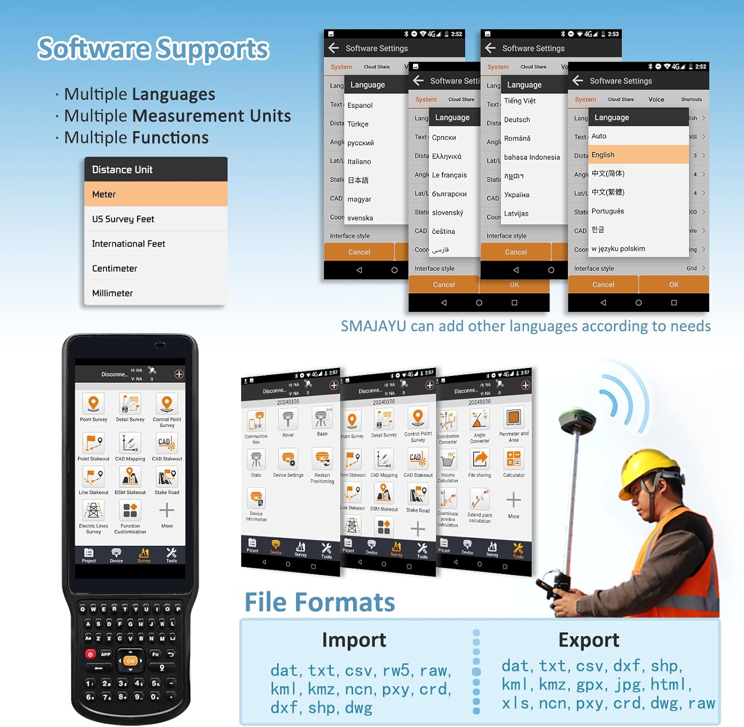
【Multilingual Interface】 Supports over 40 languages, including English, Spanish, Portuguese, German, French, Italian, Arabic, and more — making it truly global
【Flexible File Format Support】 Import: .dat, .txt, .csv, .rw5, .raw, .kml, .kmz, .ncn, .pxy, .crd, .dxf, .shp, .dwg Export: .dat, .txt, .csv, .dxf, .dwg, .shp, .kml, .kmz, .gpx, .jpg, .html, .xls, .ncn, .pxy, .crd, .raw (saved in project)
【Full-Frequency, Full-Constellation Support】 Compatible with global systems and built for extreme conditions. Adaptable for use in any country or challenging environment: GPS: L1C/A, L2P(Y), L2C, L5 GLONASS: G1, G2, G3 BeiDou (BDS): B1I, B2I, B3I, B1C, B2a, B2b* Galileo: E1, E5a, E5b, E6* QZSS: L1, L2, L5


Use WEBUI to set Base and Rover


 Company Rating